

HIGH ROUTE OF THE LOST
Tour of Vignemale with summit
-
 4 stages
-
 61.1 km
-
 +4680 m/-4680 m
-
 Difficulty: High
The perfect balance between high-altitude adventure and the technical challenge of conquering a legendary peak. The Tour de Vignemale with ascent of the Gran Vignemale transforms the classic route into a 4-day circular trek designed for those seeking to touch the sky of the French Pyrenees.
As of
449,00 €
HIGH ROUTE OF THE LOST
Tour of Vignemale with summit
-
4 stages
-
61.1 km
-
+4680 m/-4680 m
-
Physical Difficulty: Medium
-
Technical Difficulty: High

ENJOY TO THE FULLEST
THE ROUTE
DAY 1
Place of origin: Bujaruelo Refuge
Arrival at the Bujaruelo Refuge, where we will welcome you, introduce ourselves and have an explanatory talk. At this meeting point we will give you the welcome pack, we will see the details of the route, the conditions of the mountain, and we will teach you how to use the security geolocator device that you will have at your disposal during the whole itinerary. Here you will be able to solve your last minute doubts. And from here begins the fantastic adventure that will take us through some of the most spectacular landscapes of the Pyrenees. All this enlivened with a welcome snack.
DAY 2 / STAGE 1
Port of Bujaruelo and Gavarnie
-
16.6 Km
-
+1,124 m/-1,124 m
From the Bujaruelo Refuge to the Grange de Holle Refuge
The route begins at the Bujaruelo Refuge and climbs along mountain trails that cross forests and alpine meadows, entering the Pouey d'Aspé valley until reaching the Bujaruelo Pass (2,273 m), from where a spectacular view opens up towards the Vignemale massif and the valley that leads to France.
We continue the route to the Soldiers' Cabin and the Bellevue Plateau, before descending gently to the La Grange de Holle Refuge, nestled in a high mountain setting with magnificent views over the Gavarnie Valley.
Those who wish can take an optional detour to the Cirque de Gavarnie, a World Heritage Site, adding approximately 2 hours of walking to enjoy its impressive walls and the highest waterfall in the Pyrenees before returning to the main itinerary.
DAY 3 / STAGE 2
Gavarnie to Baysellance
-
15.4 Km
-
+1,468 m/-320 m
From the Grange de Holle Refuge to the Baysellance Refuge
From the La Grange de Holle refuge, we follow trails that cross alpine pastures and wooded areas until we reach the Barrage d'Ossoue, the starting point for the climb up to the high mountains of the Vignemale massif.
The trail climbs gradually up the moraine of the Ossoue glacier until it reaches the Bayssellance Refuge (2,651 m), the highest guarded refuge in the Pyrenees, located in a spectacular setting dominated by glaciers and high peaks, where we will spend the night.
DAY 4 / STAGE 3
Ascent of the Grand Vignemale and Oulettes de Gaube
-
12.5 Km
-
+1,177 m/-1,665 m
From the Baysellance Refuge to the Grand Vignemale
From the Bayssellance Refuge, we tackle the ascent of Vignemale (3,298 m), the highest peak in the French Pyrenees. The route runs through glacial and high mountain terrain, so crampons, ice axes, and helmets are mandatory, as is previous experience in glacial terrain and ascents of this level. The summit offers an exceptional panoramic view of the Vignemale massif, the northern glaciers, and the Gaube Valley.
After descending back to the Bayssellance Refuge, we resume the traverse by crossing the Horquette d'Ossoue (2,734 m), a high mountain pass that can retain snowfields even in summer. From here, we descend through the spectacular Gaube glacier valley, following the HRP markings until we reach the Oulèttes de Gaube Refuge, located at the foot of the imposing north face of Vignemale.
Optionally, if you wish to join an organized group with a high mountain guide exclusively for this ascent, please contact us and we will provide you with available dates and a quote.
DAY 5 / STAGE 4
The Reward
-
16.6 Km
-
+982 m/-1,446 m
From the Oulèttes de Gaube Refuge to Bujaruelo
From the Oulèttes de Gaube refuge, we begin the day heading towards Collado de los Mulos, ascending high mountain trails with constant views of the Vignemale massif. After reaching the pass, we begin the descent following the red and white markings of the HRP, which we leave behind later to enter the Ara Valley.
The route continues with a long, gradual descent through alpine meadows and mountain forests until we reach the Romanesque bridge of San Nicolás de Bujaruelo and the Bujaruelo Refuge, bringing this spectacular high-mountain circular route around the Vignemale to a close.
HIGH ROUTE OF THE LOST
REFUGIOS
REFUGIOS
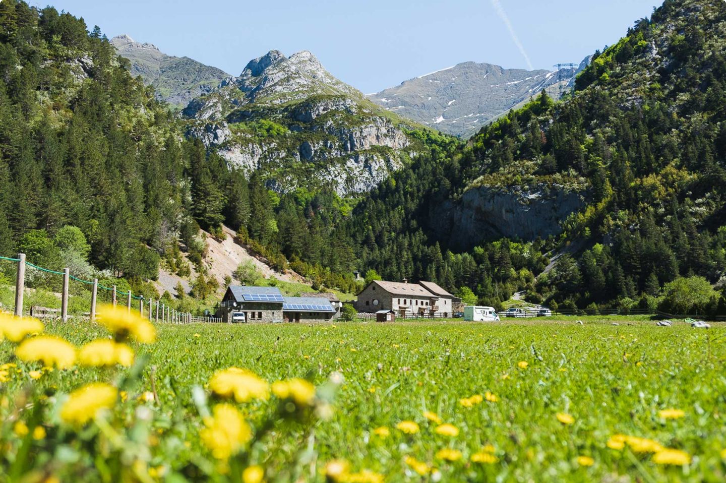
Bujaruelo
Guards: José Luis, Rafa and Esther
Rooms: 2, 4, 8 and 20 seats.
Necessary: Saco or sheet
Includes: Comforters
Bathroom: With hot water shower
Breakfast: From 7am
Dinner: From 8:30 pm
Extra services: Pic-nic and cafeteria (7h - 22h).
REFUGIOS
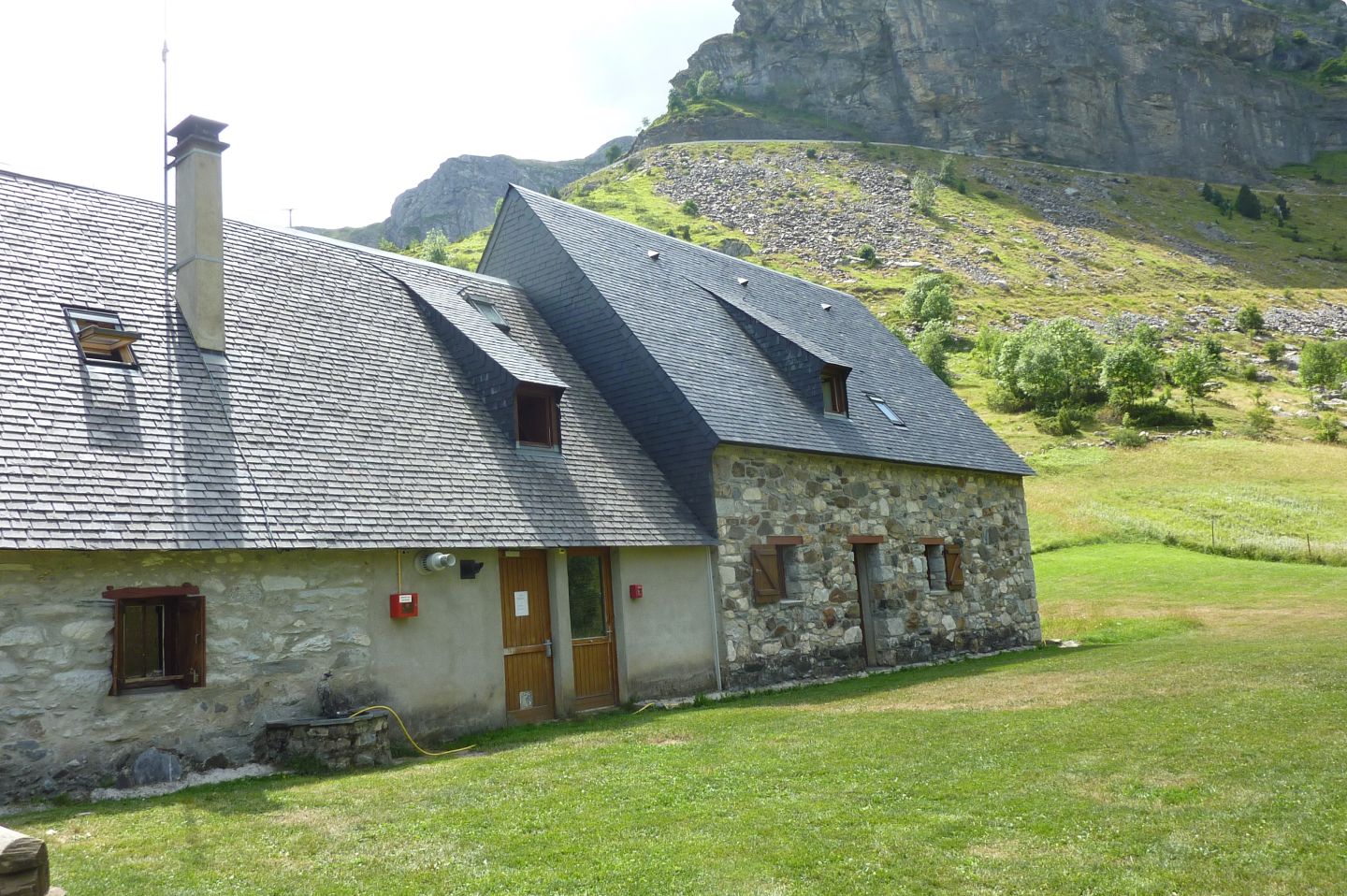
Refuge La Grange de Holle
Guards: Amelie and Philippe
Rooms: Communal
Includes: Blankets
Bathroom: With hot water shower
Dinner: Shifts at 19h in summer.
Extra services: Pic-nic and bar

REFUGIOS
Oulèttes hut
Guards: Emma and Philippe
Rooms: Communal
Includes: Blankets
Bathroom: With hot water shower
Dinner: Shifts at 19h in summer.
Extra services: Pic-nic and bar
ENJOY TO THE FULLEST
ADDITIONAL INFORMATION
Includes
All of this is included in your adventure:
Total Safety: Garmin device with geolocation and satellite technology. Includes constant professional monitoring by our team. Guaranteed communication with us even without cell service and an SOS button that immediately activates the rescue protocol.
Comfort: Half board at all shelters + Picnic at the Bujaruelo Shelter.
Management: Registration and full reservation of guaranteed places.
Material: Official map of the Alpina route, official T-shirt, and passport for stamping at mountain huts.
Experience: Technical briefing in Bujaruelo, welcome drink at each refuge, and final toast.
Does not include
1. Transfers to/from Bujaruelo (ask us if you need transportation).
2. Personal expenses and tips.
3. Expenses derived from unexpected events, either by third parties or meteorological events (delays, cancellations, floods, landslides, snowfalls, natural disasters, etc.). New: you can take out the flexible cancellation insurance to cover these situations.
4. Any service not specified in the "Included" section.
Rates for 2026
Non-member: €464
Member (*): €449
(*) The federated price includes both FEDME and hut correspondence.

Extra Services
Accident insurance for the whole trip: 30 € per person consult conditions here.
Early cancellation insurance: 50 € per person check conditions here.
Flexible cancellation insurance: 99€ see conditions here.
Rental of Petlz ice axes and crampons: pack (6€ per day) / 1 tool (3€ per day).
Exclusive Ternua T-shirt: 18€
Optionally, if you wish to join an organized group with a high mountain guide exclusively for this climb, please contact us and we will provide you with available dates and a quote.


MORE THAN AN EXPERIENCE
More than just walking, you embark on a unique experience that begins long before you take your first step on the mountain.

Safety at every step
You will feel safe thanks to the latest technology in real-time monitoring, which allows us to intervene quickly if something does not go according to plan.

LEARNING AT EVERY STEP
Learn and evolve as a mountaineer with the videos and trainings we offer you, improving your skills to enjoy every mountain adventure to the fullest.


