
Waters of Aneto

PIONEERS

Follow the original route born out of a passion for Maladeta.

This route is the result of a shared vision between a refuge warden and a mountain guide, who designed this loop to connect the most authentic corners of the massif. It offers you an itinerary with character that prioritizes the most historic passages and the spirit of early explorations. It consists of four days of pure mountain experience for mountaineers who value the authenticity of a route designed "from within" by those who know every rock and every mountain lake best.

As of

460,00 €

WATERS OF ANETO

PIONEERS

  • 4 stages
  • 57.2 km
  • +4,623 m/-4,623 m
  • Physical Difficulty: High
  • Technical Difficulty: High
Aguas del Aneto 4 stages

FOLLOW THE TRAIL

THE ROUTE

DAY 1

Place of origin: Casau

Arrival at the Petite Verneda mountain hotel, where we will welcome you, introduce ourselves, and give a brief orientation talk about the high mountain crossing.
At this meeting point, we will give you your welcome pack, review the details of the route and the mountain conditions, and show you how to use the safety geolocation device that will be at your disposal throughout the tour. Here you can ask any last-minute questions and finish preparing your mountain equipment before beginning this adventure in the Pyrenees.

DAY 2/ STAGE 1

The Aran threshold: From Casau to Artiga de Lin

From Casau (Vielha) to the Artiga de Lin Refuge.

We begin our adventure in the picturesque village of Casau, a privileged balcony overlooking Vielha. The Pioneers' Route begins with a steady climb that allows us to quickly gain altitude above the Aran Valley. We will cross centuries-old forests and alpine meadows until we reach the divide that gives us our first great view of the massif. The descent leads us to the natural sanctuary of Artiga de Lin, where we witness the spectacle of the Uelhs deth Joèu, the impressive resurgence of the waters of Aneto, an amphitheater of rock and life where the force of nature can be felt in every corner.

DAY 3/ STAGE 2

The secret of the waters: From the Aran Valley to the heart of Aneto

From the Artiga de Lin Refuge to the Renclusa Refuge via the Puerto de la Picada pass.

This stage is pure geological magic. After leaving Artiga de Lin behind, we face the ascent to Puerto de la Picada, a historic pass used by early explorers. As we cross the natural border, the colossus of the Pyrenees, Aneto, appears before us in all its majesty. We descend in search of Plan d'Aigualluts, where we witness the phenomenon of Forau: the exact point where the meltwater disappears to feed the eyes we saw yesterday. A short final ascent takes us to the iconic Refugio de la Renclusa, the historic base for great Pyrenean feats.

DAY 4 / STAGE 3

The passage of giants: Conquest of Pico Mulleres

From the Renclusa Refuge to the Conangles Refuge.

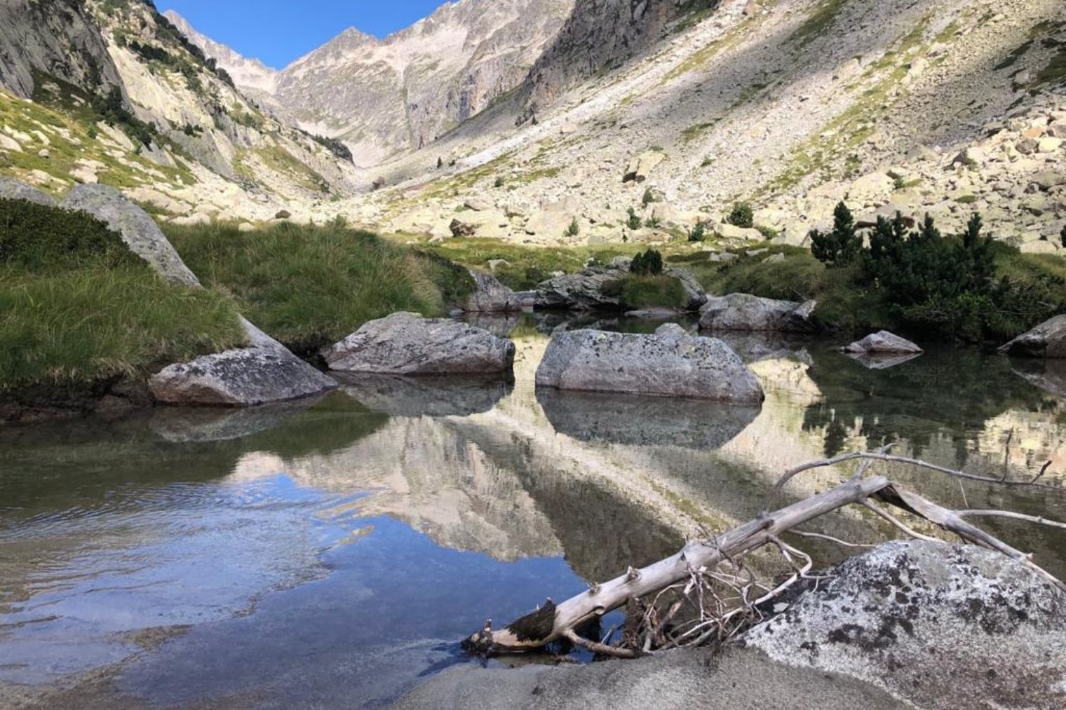
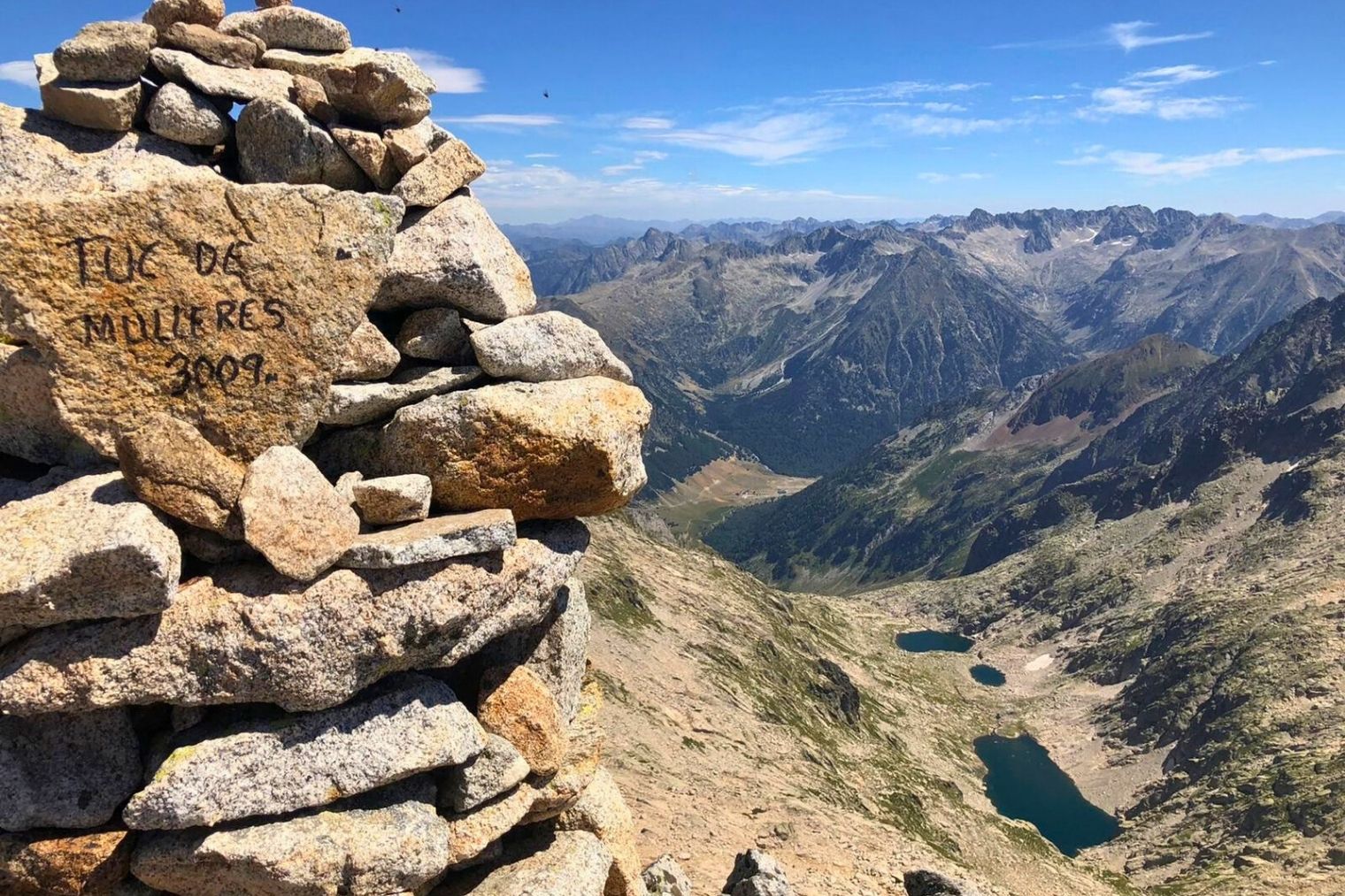
Today, the Pioneer Route reaches its climax and wildest point. We leave La Renclusa and head towards the Barrancs Valley to face the great challenge of the day: we climb to 3000 meters, Pico Mulleres (3,010 m). Reaching this summit gives us one of the most impressive panoramic views of the Maladetas ridge and the Aneto Glacier. The high mountain terrain, dominated by granite blocks and the silence of the peaks, will demand our attention and sure footing. After successfully reaching the summit, we will begin a long and demanding descent through the Mulleres Valley, passing by its mountain lakes and spectacular waterfalls until we are once again immersed in the forest surrounding the Conangles Refuge.

DAY 5 / STAGE 4

The return of the traveler: The historic Port of Vielha

From the Conangles Refuge to Casau (Vielha).

On the last day of the Pioneers' Route, we come full circle by returning to our origins through the living history of the Pyrenees. We begin the ascent to cross the iconic Vielha Pass, a historic crossing point used for centuries by merchants and travelers, and today a privileged balcony offering a dreamlike farewell to the Maladeta massif. From this point, the final descent to Casau allows us to enjoy a unique transition in vegetation, from the high mountains to the lush Aranese forests, returning to the starting point with our eyes full of peaks and the pride of having walked like a true pioneer.

WATERS OF ANETO

ADDITIONAL INFORMATION

Includes

All of this is included in your adventure:

Total Safety: Garmin device with geolocation and satellite technology. Includes constant professional monitoring by our team. Guaranteed communication with us even without cell service and an SOS button that immediately activates the rescue protocol.

Comfort: Half board in all shelters

Management: Registration and full reservation of guaranteed places.

Material: Official map of the Alpina route, official T-shirt, and passport for stamping at mountain huts.

Experience: Technical briefing, welcome drink at each shelter, and final toast.

Does not include

1. Transfers to/from Conagnes (contact us if you need transportation).
2. Personal expenses and tips.
3. Expenses arising from unexpected events, whether caused by third parties or weather conditions (delays, cancellations, floods, landslides, snowfall, natural disasters, etc.). New: you can take out flexible cancellation insurance to cover these situations.
4. Any service not specified in the "Includes" section.

Rates for 2026

Non-member: €475
Member (*): €460

(*) The federated price includes both FEDME and hut correspondence.

Extra Services

Accident insurance for the entire trip: €30 per person, see conditions here.
Early cancellation insurance: €50 per person see conditions here.
Flexible cancellation insurance: €99 see conditions here.
Exclusive Ternua T-shirt: €18

Aguas del Aneto Pico Mulleres

MORE THAN AN EXPERIENCE

More than just walking, you embark on a unique experience that begins long before you take your first step on the mountain.

Safety at every step

You will feel safe thanks to the latest technology in real-time monitoring, which allows us to intervene quickly if something does not go according to plan.

LEARNING AT EVERY STEP

Learn and evolve as a mountaineer with the videos and trainings we offer you, improving your skills to enjoy every mountain adventure to the fullest.

What do routers say about their experience with Alta Ruta?

YOUR EXPERIENCES

Published on Google Google
Ernesto Ginel's profile picture
Ernesto Ginel
Google Star 1Google Star 2Google Star 3Google Star 4Google Star 5Trustindex verifies that the original source of the review is Google.
The route was a great experience, and the excellent organization behind it—especially with the self-guided option—gives you the peace of mind you need to focus solely on enjoying the mountains. You don’t have to worry about booking mountain huts, maps, GPS tracks, hazardous areas, etc.—you can just enjoy yourself, knowing that if any problems arise along the way, they’ll be there to help. It’s been fantastic to discover these areas of the Pyrenees (Los Perdidos and Moliere-Besiberris) with them and in this way.
Published on Google Google
Anthony Grumbach's profile picture
Anthony Grumbach
Google Star 1Google Star 2Google Star 3Google Star 4Google Star 5Trustindex verifies that the original source of the review is Google.
Patricia and her team at La Alta Ruta were wonderful to work with. They helped us plan and book a customized 9-day trek along La Alta Ruta de Los Perdidos, made the refuge reservations, assisted us with transportation to and from Bujarueles, and provided accurate information and GPX tracks for the trail. They were responsive, knowledgeable, and reliable. The background essays they shared in weekly emails before the trip deepened our appreciation of the route’s geology, history, and culture. With their GPX files, paper map, and brief orientation meeting, we completed the route on our own, never needing to contact them during our trek—though we were reassured to know we could reach out if we needed help during an emergency in a foreign country. We’ve planned many of our own backpacking routes, but it was helpful and important to have their experienced guidance regarding what was unfamiliar, foreign territory for us. There are trail junctions with alternative routes that present different challenges, levels of exposure, or views. And while we were often on clearly defined and well-maintained trails, at other times the trails were more primitive—somewhat like being on a well-established cross-country route in the U.S. wilderness but with trail markers and more cairns. The Alta Ruta de Los Perdidos is as beautiful and challenging as described in other online trip reports and reviews. We are experienced backpackers in our 60s who are in good physical condition but are not competitive athletes. On our 9-day itinerary in early September 2026, many days were pleasantly long and tiring, but we built in some easier days that gave us time to take a break from the bustling refugios at a hotel in Gavarnie, climb a peak, take a day hike on a side trail, or simply savor a fantastic view and a beer at a picnic table outside a refugio. We found the refugios to be a fun contrast to our usual, much more isolated backpacking at home. We made a lot of new friends from Spain and other countries. We still had plenty of peaceful time in the mountains to ourselves during our days on the generally uncrowded trails. There was drinking water at every mountain hut. But because these trails have been used by sheep and cattle herds for centuries, when we refilled our bottles from streams or springs during the day, we both filtered and treated the water, as La Alta Ruta advised. I highly recommend this route and working with La Alta Ruta to plan a self-guided trip. And judging by the very happy hikers we dined with one night—who were with one of La Alta Ruta’s local guides—I’d also recommend their guided tours if that’s your preference.
Published on Google Google
Eva Rodriguez's profile picture
Eva Rodriguez
Google Star 1Google Star 2Google Star 3Google Star 4Google Star 5Trustindex verifies that the original source of the review is Google.
Everything was great; our guide, Toño, was very helpful throughout and very knowledgeable. I really enjoyed both the guide and the rest of the group. I'll be back next summer to do the entire Alta Ruta.
Published on Google Google
Julen Legorburu's profile picture
Julen Legorburu
Google Star 1Google Star 2Google Star 3Google Star 4Google Star 5Trustindex verifies that the original source of the review is Google.
A wonderful experience on a beautiful route, very well organized
Published on Google Google
Patxi's profile picture
Patxi
Google Star 1Google Star 2Google Star 3Google Star 4Google Star 5Trustindex verifies that the original source of the review is Google.
At the end of August, six of us completed the Monte Perdido Tour, including the ascent of Monte Perdido. A wonderful experience and extremely professional organization!!!!
Published on Google Google
Jaume Julibert's profile picture
Jaume Julibert
Google Star 1Google Star 2Google Star 3Google Star 4Google Star 5Trustindex verifies that the original source of the review is Google.
In my case, the Alta Ruta de Molieres y Besiberris. A demanding route with technical sections that aren’t suitable for everyone. Top-notch organization: briefing, GPS tracking in case of any serious mishap or emergency, comprehensive information in the days leading up to the trip, daily monitoring, a phone line that answers any issues, alternative routes in case of bad weather, and services included at every overnight stop (mountain hut or hotel—and by the way, it’s a great idea to spend two nights in hotels); in other words, they take care of everything, and all you have to do is focus on the hike and enjoy “paradise.” A very secluded but incredibly beautiful route, covering three 3,000-meter peaks, with options to tackle a couple more along the same route. I’d do it again in a heartbeat!!! Thank you so much for everything!!!!
Published on Google Google
Manuel Riveiro's profile picture
Manuel Riveiro
Google Star 1Google Star 2Google Star 3Google Star 4Google Star 5Trustindex verifies that the original source of the review is Google.
A fantastic route—a hike to enjoy and have a wonderful experience